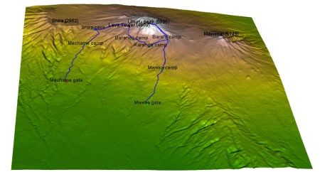
3D route visualisation – Kilimanjaro
I will present here the code for creation of an interactive 3D visualisation of geospatial data, using rgl library, that allows export of the results into html. The dataset to visualize, is a 7 day track to Kilimajaro mountain (5895) in Tanzania. Dataset contains latitude, longitude and elevation at sequence of timestamps. ...