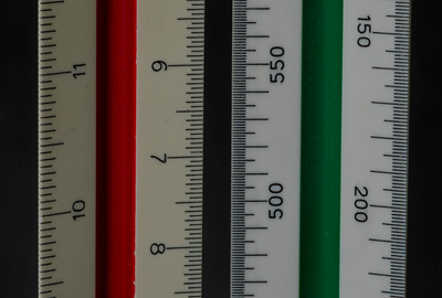
Articles by Michael

Scales

November 11, 2022 | Michael

Scale rulers – © by Frank Day 12 of 30DayMapChallenge: « scales » (previously). French « départements » at the same size but tidily ordered by area, using data from Adminexpress made in Simplifying polygons layers. libra...
[Read more...]

Sentinel

November 11, 2022 | Michael

Day 11 of 30DayMapChallenge : « red » (previously). Today no cartography in R but in QGIS. However the satellite image processing has been made with the {sen2R} package. We emulate infrared photography with a combination of the 8, 4 and 3 bands from the Sentinel-2 satellites, aimed at Termignon in the Vanoise National Park. Glaciers (... [Read more...]

Sentinel

November 10, 2022 | Michael

Termignon – CC-BY-NC-ND by Marcel Holyoak Day 11 of 30DayMapChallenge: « red » (previously). Today no cartography in R but in QGIS. However the satellite image processing has been made with the {sen2R} package. We emulate infrared ...
[Read more...]

Get lost

November 9, 2022 | Michael

Day 10 of 30DayMapChallenge: « bad map » (previously). Just resampling… library(tidyverse) library(sf) library(glue) library(ggspatial) library(ggrepel) library(rnaturalearth) set.seed(4326) # final projection map_proj
[Read more...]

The giant French Olympic-size swimming pool

November 9, 2022 | Michael

Day 7 of 30DayMapChallenge : « Openstreetmap » (previously). What if all private swimming pools could be merged into one 25 m width pool? OSM is not just a map, it’s a database, so ask OSM… I know that not all swimming pools are present in OSM, but it’s just an exercise 🙂 and ...
[Read more...]

Use data from Wikipedia

November 8, 2022 | Michael

Ariane 5 – CC BY-NC-ND by NASA HQ PHOTO Day 9 of 30DayMapChallenge: « space » (previously). Scrape and geolocate data from Wikipedia. We will map the active space launch sites. library(tidyverse) library(lubridate) library(janitor...
[Read more...]

The giant French Olympic-size swimming pool

November 7, 2022 | Michael

pool swimming – CC BY by VV Nincic Day 8 of 30DayMapChallenge: « Openstreetmap » (previously). What if all private swimming pools could be merged into one 25 m width pool? OSM is not just a map, it’s a database, so ask OSM… I ...
[Read more...]

Use data from data.gouv.fr

November 5, 2022 | Michael

TGV – CC BY-NC-ND by Enzo JIANG Day 6 of 30DayMapChallenge: « network » (previously). Using GIS data directly from data.gouv.fr : railways network of France. library(dplyr) library(ggplot2) library(sf) library(glue) library(httr) ...
[Read more...]

Use data from Openstreetmap

November 4, 2022 | Michael

Kyiv, bridges on Dnieper – CC by Nick S Day 5 of 30DayMapChallenge: « Ukraine » (previously). Using {osmdata} to extract streets: library(tidyverse) library(sf) library(osmdata) library(ggspatial) library(glue) ua_bbox
[Read more...]

Opening a spatial subset with {sf}

November 4, 2022 | Michael

Intersecting an area of interest with a layer at opening time Days 3 and 4 of 30DayMapChallenge : « polygons » and « green » (previously). The CORINE Landcover dataset is distributed as a geopackage weighting more than 8 Go. To limit the memory used when we only work on a subset, we can clip it at opening ... [Read more...]

Opening a spatial subset with {sf}

November 3, 2022 | Michael

Wine villages – CC BY-NC by Lefteris Katsouromallis Day 3 and 4 of 30DayMapChallenge: « polygons » and « green » (previously). Intersecting an area of interest with a layer at opening time The CORINE Landcover dataset is distributed as a g...
[Read more...]

My air travel carbon footprint

November 2, 2022 | Michael

Flygskam (in Mercator projection) – r.iresmi.net Day 2 of 30DayMapChallenge: « Lines » (previously). I shouldn’t have… library(tidyverse) library(sf) library(glue) library(rnaturalearth) library(units) # grams of carbon dioxide-e...
[Read more...]

Extract POIs from a Suunto watch

November 2, 2022 | Michael

Vintage Suunto – CC-BY by Mikael Leppä Day 1 of 30DayMapChallenge: « Points » (previously). The Suunto watches (Spartan, Suunto 9,…) can record waypoints (or POIs) but although they can be visualized in the Suunto app (or on t...
[Read more...]

Extract POIs from a Suunto watch

November 2, 2022 | Michael

The Suunto watches (Spartan, Suunto 9,…) can record waypoints (or POIs) but although they can be visualized in the Suunto app (or on the watch), they cannot be exported to be used with other tools. It used to be possible to access them from the Movescount website but it was discontinued ... [Read more...]

Simplifying polygons layers

October 15, 2021 | Michael

The current 2021 french administrative limits database (Adminexpress from IGN) is more detailed than the original version (from 50 MB zipped in 2017 to 500 MB zipped now), thanks to a more detailed geometry being currently based on the BDTOPO. However we don’t always need large scale details especially for web applications. The ... [Read more...]
1 3 4 5 6 7

Never miss an update!
Subscribe to R-bloggers to receive
e-mails with the latest R posts.
(You will not see this message again.)

Click here to close (This popup will not appear again)