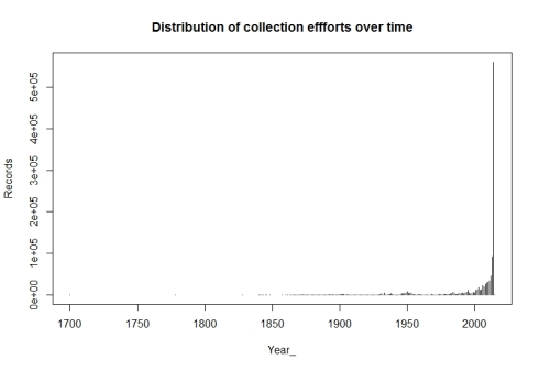
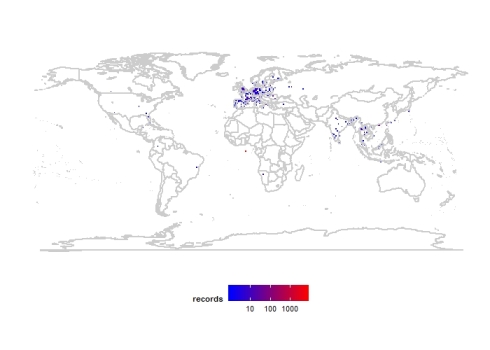
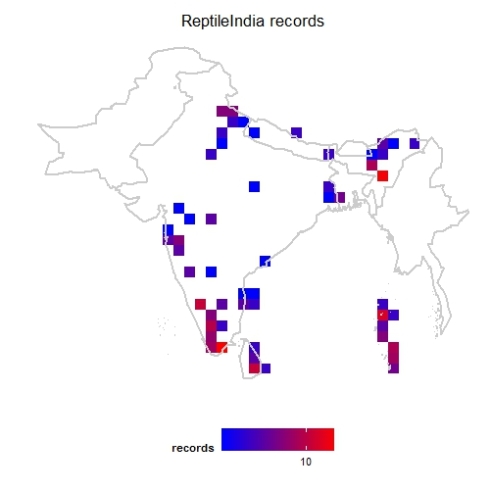
Blog Archives

GSoC Proposal 2013: Biodiversity Visualizations using R

April 29, 2013
By
GSoC Proposal 2013: Biodiversity Visualizations using R

I am applying for Google Summer of Code 2013 with this “Biodiversity Visualizations using R” proposal. I am posting this idea to get feedback and suggestions from Biodiversity Informatics community.

Read more »

Exploring distributions of Ensatina salamander subspecies using rvertnet by Neil Kelly

August 9, 2012
By
Exploring distributions of Ensatina salamander subspecies using rvertnet by Neil Kelly

This week we have a guest blog post by Neil Kelley Last week, I stumbled on Vijay’s blog post demonstrating his new package rvertnet. Although I am a paleontologist, some of my research involves anatomical comparison between extinct species and extant relatives or ecological analogs, so I have some experience using VertNet to track down

Read more »

Blue Jay and Scrub Jay : Using rvertnet to check the distributions in R

July 30, 2012
By
Blue Jay and Scrub Jay : Using rvertnet to check the distributions in R

As part of my Google Summer of Code, I am also working on another package for R called rvertnet. This package is a wrapper in R for VertNet websites. Vertnet is a vertebrate distributed database network consisting of FishNet2, MaNIS, HerpNET, and ORNIS. Out of that currently Fishnet, HerpNET and ORNIS have their v2 portals serving data. rvertnet has functions now to access

Read more »

Map biodiversity records with rgbif and ggmap packages in R

July 23, 2012
By
Map biodiversity records with rgbif and ggmap packages in R

When I attended usrR! 2012 last month, there was an interesting presentation by Dr. David Kahle about the package ggmap. It is a package built over ggmap2 and helps us map spatial data over online maps like Google maps or Open Street Maps. I decided to give ggmap package a try with biodiversity data. So

Read more »

Map biodiversity records with rgbif and dismo packages in R

July 15, 2012
By
Map biodiversity records with rgbif and dismo packages in R

In the earlier post we generated maps from GBIF biodiversity records using maps and ggplot2 packages. We used world map with country borders for that. Now we will generate maps with google maps as base layer using dismo package. Like earlier we download data for Danaus chrysippus from GBIF using occurrencelist function into a data

Read more »

Map biodiversity records with rgbif, maps and ggplot2 packages in R

July 9, 2012
By
Map biodiversity records with rgbif, maps and ggplot2 packages in R

Global Biodiversity Information Facility or GBIF is an international consortium working towards making Biodiversity information available through single portal to everyone.  GBIF with its partners are working towards mobilizing data, developing data and metadata standards, developing distributed database system and making the data accessible through APIs. At this point this largest single window data source covering wide spectrum of taxa and

Read more »